Reminder

Click on any photo to see a full screen version, then use the browser "Back" button to continue reading.

Friday, 7 February 2014

Day 17 - 20 Red Center

This is the fifth installment of the travelogue of our trip in 2011, and I hope you are enjoying it.  I've been encouraged by a number of my friends to continue, which I greatly thank for your kindness.  In case if those of you who are bored by this, please send me a email to remove you from further "sufferance", .  At the same time, I am confident that quite a few of you would find the time to explore more of Australia, this land of immense beauty and space.

Although we did this in a 4x4, but for the inexperienced ( with the term "outback"), most of the major destinations in this trip are reachable by most modern town cars.  For example, we did most part of this trip up to Lake Eyre South in a little Honda Civic back in 2009.  That trip included Lake Menindee, Broken Hill, Flinders Ranges, Marree on Oodnadatta Track and Lake Eyre South, Mungo National Park, Lake Cargelligo etc.

Anyhow, let's get back to this trip.

So after we crossed the border from South Australia into Northern Territory north of Mt Dare Station, and visited the Lambert Geographic Center of Australia, we reached back onto the major highway running through the center of Australia in the north-south axis, Stuart Highway, named after one of the great explorers of Australia who, in the mid 1800's,  first traveled inland Australia from south to north ( and returned!), John McDouall Stuart. 


For the next three weeks, we'll be following this highway somewhat, going towards Darwin, a similar trip that was done in a motorhome in 2001, when I first discovered the magical lure of the Milky Way and the many stories along the highway, especially its significance in the counter offensive against the Japanes WWII.

We left the Stuart Highway at Ernest Giles Rd and turn west towards Yulara, the home of the famed Uluru ( Ayers Rock ), It was a 230 Km detour in order to explore the Henbury Meteorite Craters which I missed in 2001 with a 2WD car.  We had the crater(s) all to ourselves, under the cloudless sky, but it was a mild day for a walk amongst these space invader marks, millions of years before the biblical age.


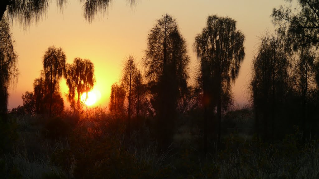
There was no establishments, of any descriptions for miles, to enquire about the time zone we were in, but it was good practice to stay off the road when approaching Sunset.  Dusk is the wake up time for nocturnal animals like Kangaroos, wombats etc., a head on encounter with one of them, even with a steel bull bar that Langi's equipped, isn't for the faint hearted.  So we pull up behind a sand dune off the main road, and setup our tent for the night.  No other car was seen on our side of the dune that night.

We left early in the morning to get to Yulara airport to pick up a friend of ours, a keen photographer who had never been in the Outback despite having been in Australia for over 20 years.  We are going to have her with us until reaching Alice Spring a week later.

After settling into the camping ground at Yulara, picked up our friend, we dashed for the World famous Uluru-Kata Tjuta National Park, where the Big Red Rock Uluru is, and also Mt Oga.


You are invited to view David's photo album: 2011 4x4 Outback Australia ( Red Center )
2011 4x4 Outback Australia ( Red Center )
Sep 1, 2011
by David
Message from David Tam:
Day 17 - 20 Crossing the Australian Outback in a 80 series 4x4
If you are having problems viewing this email, copy and paste the following into your browser:
https://picasaweb.google.com/lh/sredir?uname=Australia.dt&target=ALBUM&id=5793535350333092337&authkey=Gv1sRgCK6rxJbNqMbp6wE&feat=email
To share your photos or receive notification when your friends share photos, get your own free Picasa Web Albums account.

For the next two days, we did all the tourist things around the Uluru ( Ayers Rock ) , sunset, sunup, climbed, walked, and also explored Mt Olga, which is 30Km away.  In my opinion, I think Mt Olga is more beautiful than Uluru, though almost unknown to outsiders. 


Uluru at dusk

Mt Olga from the distance

A different angle of Mt Olga

hiking into the back of Mt Olga
Our keen photographer friend, being inexperienced, was quite eager to get to the top of Uluru, without considering her fitness condition and the difficulty of carrying a weighty and expensive SLR camera.  She was soon persuaded to drop the idea after trying the first 20 meters of the steep and slippery climb ( via a chain ), and understood why I only carry a very small camera.


On the way up, I dropped the walkie talkie that we used to communicate, and it slided to the edge of a very steep drop, a young lady ahead of me saw it, and jumped away from the chain, despite my pleading against it, she went and picked up the unit and returned to me.  A big thanks to her, but really, I rather preferred she did not do it, it was quite hairy.  It is worth mentioning that, Aborigines do not wish people to climb the Rock as it is sacred to their culture, I did not climb in 2001 for this reason, but this time,  I thought, only this time!

We also ran into quite a few travelers on Working Holiday visas, and interestingly, a number of them were from Taiwan and Hong Kong, mostly females.  I asked them why, it appears that young men from Taiwan and Hong Kong are more preoccupied with the burden of conformance; a career, establishing a new family etc. We took on a hitch hiker from Taiwan, who's been doing this for over a year around Australia.  Lying on the back of our wagon's floor as there are no more seat is quite illegal, but the thought of leaving him behind in Mt Olga to try his luck, a traffic offence is the better devil.  We also had a joyous encounter with a young Taiwanese cyclist, who was traveling with her German companion all around Australia.  On tow behind each of their bicycle, is a small trailer of their belongings and more importantly, countless containers of fresh water in 1 L sized bottles, what a spirit !


Looking beyond this Red Center of Australia, I was plotting the next trip through here, it would be going west into Western Australia via one of the notorious outback highways; the Old Gun Barrel Highway and the Great Central Rd.  While their terrains are not difficult ( I think !), but a lot of preparations will need to be done, to ensure there are fuel supplies along the way at the right time, permits  for crossing the different aboriginal land tracts, and the mechanical health of the car to ensure it can last the near 2000 Km of corrugated and dusty roads.  May be next time!  For this trip, we'll be satisfied with just going west via Darwin !


Day 21 - 23 Uluru - Alice Springs

So the journey continues.  After fueling up at Yulara, we bade farewell to Uluru, and tracked towards Kings Canyon.  As we embark, two bicycles were drawing nearer and nearer, here they were, our spirited cycling travelers from Taiwan and Germany, we slowed down and waved.  And another group of Taiwanese and Hong Kong Working Visa tourers in their car waved passed us soon down the road.


Suddenly, in the distance, this flock of camels caught my eye, crossing the highway, my heart raced as I sank the brake pedal. My fear was that, my steel bull bar would be no match for these big animals.  They raced across the highway, and merged into the landscape as soon as they appear, but fortunately, not before we capture a glimpse of them on our camera.


Feral camels have became a serious pest, contaminating precious waterholes and damaging infrastructures throughout the Australia Outback.  They were originally brought in the early 1900s with Afghan cameleers for transportation, but overtime with the decline of their use, many were set free.  Without a natural predator in Australia, their number multiplied in the wild.  There was a small international incident a few years ago, when a US news reader accused ( quite emotionally !) the then Prime Minister Kevin Rudd of engaging in genocide of camels, because, a culling program was being implemented to cut their numbers from nearly 1 million to a smaller manageable size.  But she really did not understand the huge damages these feral camels are doing to the Australian outback, threatening many Aboriginal communities of their livelihood.

On reaching the Kings Canyon, it was a balmy 30 Deg day with only a few cars in the car park.  Unlike in early August 2011, the car park was overflowed with travellers from Europe, taking advantage of their summer break. We did the walk up and down the Canyon in just over 2.5 hours.


We ran into quite a few people on the walk, surprisingly, a small group of casual tourists from Hong Kong, which is very unusual.  There is a big billabong ( oasis ) nestled behind the steep faces of the Canyon, a pristine and quiet place to have a dip, unfortunately, we needed  to get to the campsite before sunset.

Little did we know, the Taiwanese hitch hiker ( whom I gave a ride between Mt Olga and Uluru)  also reached the campsite that night with the help of a caravan neighbouring us.... a small world indeed, ie after hundreds of kilometers.  He was gradually trekking to Melbourne, where he hoped to hitch on a boat to NZ as part of his World journey....good on him, with such a great spirit.  As a hitch hiker, he had little choice but to follow the next car that can give him a ride, unfortunately, we were heading north.


From Kings Canyon we needed to pay a small fee for a permit ( from the local Aboriginals ) to travel on the Mereenie Loop Rd towards Alice Springs. Between here and Alice Springs, the roads are all dirt, however they were of very good conditions, and I was able to reach many sites in a 2WD motorhome in 2001. As we rode up and down through the beautiful Gardiner Ranges, we notices that a bush fire has been raging through in the previous day or so.  Nothing too alarming, just be alert.  As we draw close to the Tnorala Gosse Bluff, a major meteorite crater 4Km in girth, we can see the smoke rising sky high, and then the dreaded sign that said "Road Closed".  So this time, this place is beyond reach again,  but not for lacking of 4x4 capability. Sigh,


After spending a splendid walk around Glen Helen Gorge, we got to Ormiston Gorge just before sunset. where camp was setup.


During the evening, a ranger gave a very enjoyable and informational talk on animals and the environment of the West McDonnell Ranges, in the cold.  It is interesting that, while during daytime, we did not see many cars on the road, but come night time, they all seem to congregate at camp sites, it was nearly full with about 20 -30 sites.  And there was hot water showers for all.


We set off quite early in the morning to continue our drive towards Alice Springs, veering into different interesting sites, whilst driving along the majestic West MacDonnell Ranges. It has always been a urge to climb these majestic mountains, may be next time!


Before arriving Alice Springs, we pay homage to the grave site of John Flynn, the founder of the Royal Flying Doctors Services ( http://www.flyingdoctor.org.au/About-Us/Our-History ). It is worth mentioning that the RFDS is the oldest and largest of its kind in the World, providing essential health services to many remote outback communities throughout Australia.


You are invited to view David's photo album: 2011 4x4 Outback Australia (Uluru - Alice Spring)
2011 4x4 Outback Australia (Uluru - Alice Spring)
Sep 5, 2011
by David
Message from David:
Day 21 - 23 Uluru - Kings Canyon - Alice Springs via Mereenie Loop Rd. Visited Kathleen Springs, Kings Canyon, Red Bank Gorge, Glen Helen Gorge, and overnighted at Ormiston Gorge, then Ochre Pit, Serpentine Gorge, Standley's Chasm, Simpson Gap and J. Flynn's grave ( the founder of the Royal Flying Doctors Services). All told, 750 Km travelled.
If you are having problems viewing this email, copy and paste the following into your browser:
https://picasaweb.google.com/lh/sredir?uname=Australia.dt&target=ALBUM&id=5807834473966874369&authkey=Gv1sRgCJW9i--Q8MXtTw&feat=email
To share your photos or receive notification when your friends share photos, get your own free Picasa Web Albums account.


We checked into our campsite just outside of Alice Spring town center before sunset.  During the early, evening, a splinter in my finger, plus a raging sore neck which has been a bother for 2 weeks is starting to remind me to check them out at the nearest hospital, the first we are able to find for a long time.  So I went into the Alice Spring Hospital.  The wait was not long, which is a pleasant surprise.  The eager intern who was attending to my conditions, could not throw much hope about the sore neck other than some pain killers, which confirmed my suspicions, only physio and time will help.

However, she was eager to operate on my finger for the splinter if not for an experienced doctor whom she sought a second opinions whilst preparing all the equipment.  The doctor advised me to not operate and leave it, for the operation may cause a lot of inconvenience than its worth, especially when I am on such a long road trip into remote areas. For the operation will cause a bigger wound, which will need more medical attention until it heals.  So its better to bear and grunt about the splinter, until it come out by itself eventually, in a couple of weeks, which it did.  This goes to show how experience really count in this instance, rather than the new and eager.

By the way, splinters in fingers are almost a given in many remote trips...

Day 24 - 27 Stuart Hwy

It might not seem long when one is on the road, to have passed 23 days camping under the Milky Way, passing one wilderness then another.  Finally, we reached a city that boasts Woolworth, Coles and the like, it really was a cultural shock to see all those traffics on the road.  Although Alice Springs is not a major city by any stretch, but nevertheless, it has many traffic lights...!  And strong mobile phone signals, and most of the trappings that city folks are taking for granted....buildings that are more than 2 stories high one after another, argh!!


After whiskering our friend to the airport, for her to meet civilisation, we whipped through the downtown of Alice in no time. While having a light lunch at the War Memorial, overlooking those wonders of human habitations, we listened to stories by other 4x4 travelers, the challenges that they've ran into not even 24 hours ago, with their smiles glistening with satisfaction.


Soon we have to leave Alice for the wonderland ahead. And we set our wheels rolling north.  This was going to be black top for the next 1500 Km.  We decided to leave some of the more challenging side tracks for the next time, until I am more confident of the mechanical well being of the front wheels....that's until we reach Darwin.

Stuart Hwy is the only major highway linking Alice to Darwin, and for that matter, to Port Augusta in the south, where it is a mere 300Km to Adelaide, the nearest metropolis.  Soon aftere leaving Alice, we reached the highest point of Stuart Hwy, on this flat continent we have, it isn't much, 600 m above sealevel, a boulder like height in the Himalayas.  But Stuart Hwy has a very rich history, born out of WWII - the allies counter-offensive against the Japanese, but we'll get to that as we move north.


Very shortly, we also crossed the Tropic of Capricorn line, as we moved into the tropical parts of Australia....believe me or not, there was a temperature difference of 2 degrees before and after the line..... and pigs do fly!!!

The day wore on, we encountered quite a few "Road Trains", these are mammoth trucks, with 3 or 4 trailers in tow, up and down this highway.  To overtake these, requires patience and sometime co-operation from the truckie, fortunately, most of them are quite friendly.  But then, again, I was quite happy to chuck along at 90 - 100 Kph, taking in the scenery.  Not that there is much to see, with pretty barren lands on both side, boredom breeds fatigue.  So sometime the overtaking of a road train, provides a bit of adrenalin rush, but it is not a mindless thing to do, for sure.


Our first stop after Alice Springs, 420 Km away, is the Devils Marble.  The marbles are round boulders, weathered into shape over millions of years. due to the unique geological characters of the area.  10 years ago, I ran into this place by accident, but that one night of experiencing the gloriously red sunset over the horizon sitting on one of these boulders, followed by a night show of remote fire rings, caused by bush fire burning in the distance, had forever marked me. 


This time was no exception, the sunset was equally glorious.  All except the wind was ferocious, and there were a few dingos around, foraging for food scraps.  It is common knowledge that campers should  never feed feral animals food or to leave them anything to search for, but unfortunately, few people still do. 


This is the reason why they wander about in the camping grounds.  In the end, we strapped the tent between the car and a camping table, and took all food containers inside before retiring. And my new pair of clogs from Alice went inside also, as I learned from Dalhousie Springs couple of weeks earlier.  There was no big bush fire during the night, and the Milky Way came through as surreal as ever.


You are invited to view David's photo album: 2011 4x4 Outback trip ( Stuart Hwy )
2011 4x4 Outback trip ( Stuart Hwy )
Sep 8, 2011
by David
Message from David:
Long slog on Stuart Hwy for 2 long days
If you are having problems viewing this email, copy and paste the following into your browser:
https://picasaweb.google.com/lh/sredir?uname=Australia.dt&target=ALBUM&id=5796338801440652945&authkey=Gv1sRgCN3Mx-GQr_HMrQE&feat=email
To share your photos or receive notification when your friends share photos, get your own free Picasa Web Albums account.


Sunrise at the Devils Marble was equally glorious, and there was no more howling wind.

The drive to Tennant Creek, was uneventful.  Tennant Creek is a "major" town on the highway, connecting another highway to the east is Mt Isa, a major mining town of Australia.  There is another story to be told about my first outback driving at Mt Isa some 32 years ago, after two of us missed a flight out of the town on a late friday afternoon, I'll leave this for another day.  I wonder if how many can still remember TAA, the other half of the flying kangaroo.

We passed Tennant Creek after a brief stop to fuel and have an ice cream in the searing heat.

After 2 more uneventful days of fatigue inducing driving, we rolled into the famed Katherine Gorge, this is tropical Australia proper!  But at September, the wealther is also dry and temperature in the early thirties.  We camped at the famous Katherine Gorge.

This persistent little thing kept harping for  a feed, which we would not give for obvious reason
Instead of the doing the same boat cruise down the Gorge, we decided to explore the rims of the gorge by walking to different vantages points on the plateau atop.  We started early to avoid the heat, which climbed to 37 C in the afternoon' Following the mud map provided, we walked up and down the southern side of the gorge and had the most captivating views of the Gorge.  It was 19Km of foot-works before returning, for a big dip in the river. This is the only time of the year when it is safe to swim in the gorge, as the dry seasons stopped the salt water crocs invading the upper reaches of the Katherine River.  Assuming of course, that the rangers had captured and sent all the remaining ones down river, it is a case of no news is good news!


After two nights at Katherine Gorge, we moved northwards to visit Edith Falls, another point on the Katherine River. An after lunch swim, which was senational when the heat was 35+, and water refreshing.


Then we headed for the most famous and the largest Natioanal Park of Australia,  the UNESCO World Heritage Listed, Kakadu National Park.